
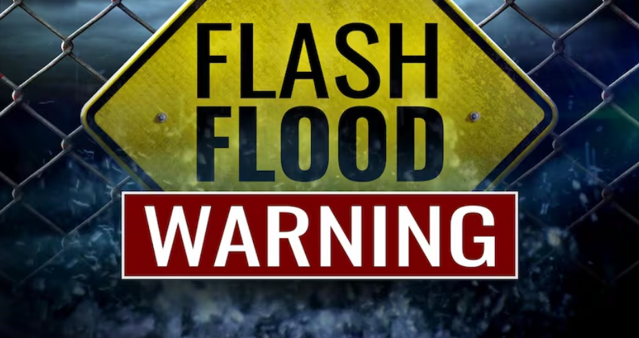
Monday morning started with an alert. A flash flood warning went into effect early. The National Weather Service issued it at 4:29 a.m. Monday. It was set to expire at 7:30 a.m. A flash flood warning that covered Topeka and surrounding counties. This wasn’t a watch. This wasn’t a possibility. This was a warning. This meant flooding was happening or about to happen. Water was rising. Creeks were swelling. The situation was urgent.
The Flash Flood Warning: Coverage Area
The flash flood warning covered a massive area. Shawnee County. Jefferson County. Eastern Wabaunsee County. Geary County. Southeastern Dickinson County. Northern Morris County. Southeastern Pottawatomie County. Southeastern Riley County. Southern Jackson County. Northwestern Douglas County. Northwestern Jackson County. That’s ten counties. Ten areas under active flash flood warning. All because of heavy rain dumping on central Kansas overnight into Monday morning.
The flash flood warning included major cities. Topeka. Lawrence. Valley Falls. Rossville. Oskaloosa. Tecumseh. Dover. Silver Lake. Auburn. Perry. McLouth. Meriden. Hoyt. Ozawkie. Lecompton. Clinton. Winchester. Mayetta. Junction City. Wamego. Alma. St. Marys. Alta Vista. Paxico. Belvue. Emmett. Eskridge. Maple Hill. Keene. Denison. Delia. All of these communities faced flooding Monday morning.
The flash flood warning also covered major roadways. Interstate 70 between mile markers 337 and 355. The Kansas Turnpike between mile markers 170 and 205. That meant commuters faced water over roads. Highway flooding. Impassable underpasses. If you were driving Monday morning in Kansas, the flash flood warning affected your route.
The Rainfall: How Much Water Fell
By early Monday morning, the National Weather Service reported that between 2 and 4 inches of rain had already fallen across the warned area. That’s significant. That’s heavy rain. That much water in a short period creates flooding. The flash flood warning existed because this amount of rain was genuine and ongoing.
But the rain wasn’t done. The National Weather Service warned that additional rainfall of 1 to 3 inches was possible in the warned area. That meant 5 to 7 inches total. That’s not just heavy. That’s catastrophic for drainage systems. Small creeks become raging torrents. Urban areas become rivers. The flash flood warning took on even more urgency when you realized more rain was coming.
The Timeline: When It Started and When It Ended
The flash flood warning was issued at 4:29 a.m. Monday. That was early. That was before most people woke up. Most commuters were still sleeping when authorities issued the warning. The flash flood warning set an expiration time of 7:30 a.m. Monday. That gave residents and commuters roughly three hours to deal with the situation.
Those three hours mattered. That was during the morning commute window. People would be leaving for work. Kids would be heading to school. The flash flood warning meant all of that had to adjust. People had to check road conditions. People had to take alternate routes. People had to change their plans because of water.
The Situation: Flash Flooding Was Ongoing
The National Weather Service stated clearly: flash flooding is ongoing or expected to begin shortly. That meant water was already over roads. Water was already in streets. Water was already in creeks and streams. The flash flood warning wasn’t about what might happen. It was about what was happening right then.
The flash flood warning cited the cause: thunderstorms producing heavy rain across the warned area. That’s how this started. That’s how it intensified. Thunderstorms moved in overnight. They dumped rain. Two to four inches fell quickly. The flash flood warning became necessary.
The Impacts: What Flooding Does
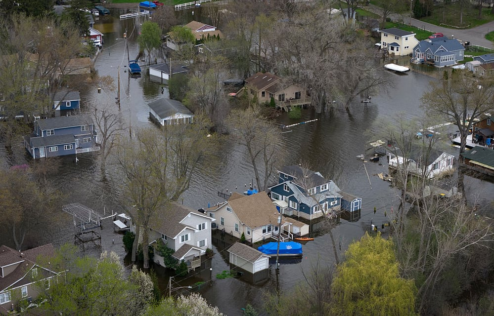
The flash flood warning warned about specific impacts. Flash flooding of small creeks and streams. Flash flooding of urban areas. Flash flooding of highways. Flash flooding of streets. Flash flooding of underpasses. Flash flooding of poor drainage areas. Flash flooding of low-lying areas. That covers everything. That covers everywhere. The flash flood warning was essentially saying everything could flood.
When water floods underpasses, those become death traps. You can’t see how deep the water is. You can’t see where the road ends. A car driving into flood water over an underpass can be swept away. The flash flood warning specifically called attention to this risk because underpasses claim lives.
The Warnings: What Authorities Said
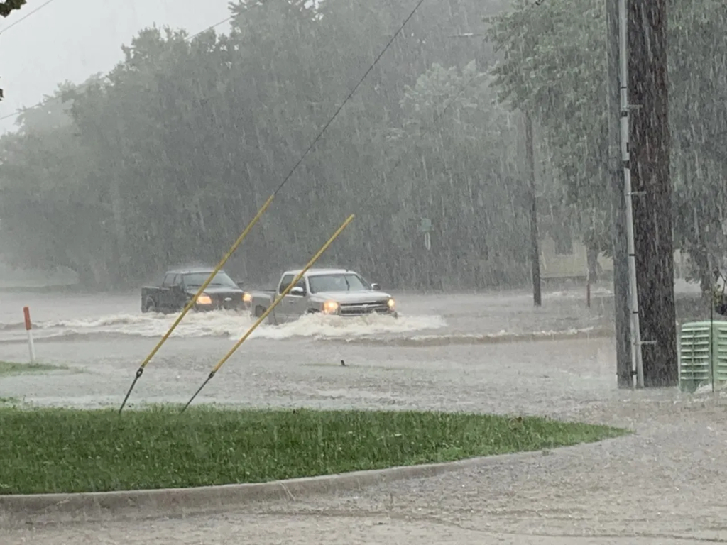
Authorities had one consistent message: if you encounter water over roadways, turn around. Find another way. Don’t drive through flood water. Don’t take the chance. The flash flood warning was backed up by this simple rule. Never drive into flood water. Never assume you can make it across. Water only 12 inches deep can sweep away a car. Water 24 inches deep will sweep away a truck.
The flash flood warning also urged people to move to higher ground. If water was rising fast, moving to higher ground could save your life. Don’t stay in low-lying areas. Don’t stay near streams. Don’t stay in areas prone to flooding. The flash flood warning was asking people to act. To move. To prepare.
The Broader Context: Multiple Rounds of Storms
The flash flood warning existed because of multiple rounds of thunderstorms. This wasn’t just one storm cell. This was waves of storms. Multiple rounds of heavy rain moving through the area. Each round brought more rain. The cumulative effect was catastrophic flooding.
The Shawnee County Emergency Management reported that multiple rounds of thunderstorms with heavy rain would increase chances for flash flooding overnight into Monday. They were right. The flash flood warning proved it. The storms kept coming. The rain kept falling. The water kept rising.
The Tornado Threat: A Secondary Concern
The flash flood warning was the primary alert. But tornado watches were also in effect. The risk for tornadoes was slightly lower than previously thought, but tornadoes could still be possible. That meant Topeka residents woke up Monday facing two threats: flooding and severe weather. The flash flood warning covered the flood threat. The tornado watch covered the severe threat. Both were active simultaneously.
This made Monday morning particularly dangerous. You couldn’t just worry about roads flooding. You had to worry about severe thunderstorms with hail and wind. You had to worry about tornadoes. You had to get to higher ground quickly but safely. The flash flood warning had to compete with other severe weather concerns for attention.
The Commute: What Monday Morning Looked Like
Monday morning was chaos. The flash flood warning meant many roads were impassable. Commuters had to avoid flooded areas. The flash flood warning forced people to take alternate routes. Alternate routes became congested. Some people chose to stay home. Some schools delayed opening. The flash flood warning disrupted the entire metro area’s Monday morning.
The impact was real. Reports came in of dozens of communities across the greater Kansas City area seeing roads flooded after creeks swelled from heavy overnight rain. The flash flood warning was precise and accurate. Flooding was widespread. The situation was severe.
The Message: Take It Seriously
The flash flood warning was not a suggestion. It was a serious alert. The National Weather Service doesn’t issue these lightly. The flash flood warning means lives are at risk. The flash flood warning means act now. The flash flood warning means don’t wait to see what happens. Don’t check the road yourself. Don’t test the water depth. Just avoid the area.
The National Weather Service message was clear: “Move to higher ground now.” That wasn’t a request. That was an order. That was a statement of how serious the situation was. The flash flood warning backed up that message with specific areas covered and specific impacts described.
The Bottom Line
A flash flood warning was issued early Monday for Topeka and vicinity. The National Weather Service issued it at 4:29 a.m. covering ten counties and multiple major cities and highways. Between 2 and 4 inches of rain had fallen, with additional 1 to 3 inches possible. The flash flood warning meant flooding was ongoing or expected to begin shortly. Impacts included creek flooding, urban flooding, highway flooding, street flooding, underpass flooding. The flash flood warning was backed by clear guidance: avoid flooded areas, move to higher ground, don’t drive through water. Monday morning became a day of disrupted commutes, closed schools, and water-covered roads. The flash flood warning proved that nature’s power requires respect. Water that looks shallow can be deadly. Water that flows over roads can destroy vehicles. The flash flood warning saved lives by giving people time to make better choices.
FAQ 1: What is the difference between a flash flood watch and a flash flood warning?
A flash flood watch means conditions are favorable for flash flooding to occur. A flash flood warning means flooding is imminent or already happening. A warning, like the one issued Monday, requires immediate action to move to higher ground.
FAQ 2: Why is “Turn Around, Don’t Drown” so important during flash floods?
Just 6 inches of moving water can knock you off your feet, and 1 foot of moving water can sweep away most passenger vehicles. Most flash flood deaths occur when people drive through flooded areas. If water is over the roadway, find another route or don’t travel.
FAQ 3: How much rain fell during the Topeka flash flood warning?
Between 2 and 4 inches had already fallen by early Monday morning when the warning was issued. The National Weather Service warned that additional rainfall of 1 to 3 inches was possible, potentially bringing totals to 5-7 inches, which is catastrophic for drainage systems.
FAQ 4: What areas were affected by the flash flood warning?
The warning covered 10 counties including Shawnee, Jefferson, Geary, and others. It included major cities like Topeka, Lawrence, and Valley Falls. It also covered major highways: Interstate 70 between mile markers 337-355 and the Kansas Turnpike between mile markers 170-205.
FAQ 5: What should you do if trapped in a vehicle during flood water?
If your vehicle is trapped in rapidly moving water, stay inside the car initially. If water starts rising inside the vehicle, get on the roof if possible and signal for help. Never attempt to swim or walk through flood waters, which can contain dangerous debris and hidden hazards.